Archivio digitale di mappe di Orienteering di Less Áron
|
Accedi
Tutti gli utenti
|
Lingua:
Italiano
Česky
Dansk
Deutsch
Eesti
English
Espa?ol
Français
Italiano
Magyar
Norsk
Polski
Portugu?s
???????
Svenska
Türkçe
???????????
|
DOMA 3.0.6
Mostra anteprima della carta
Nascondi anteprima della carta
|
KML
|
Indietro
<< Szlovák VB 2. (2017-07-07)
|
Szlovák VB 4. (2017-07-09) >>
Szlovák VB 3. (2017-07-08)
Categoria:
Verseny
Nome della mappa:
Prybilina
Organizzatore:
Tatry Orienteering
Paese:
Szlovákia
Disciplina:
middle
Risultati
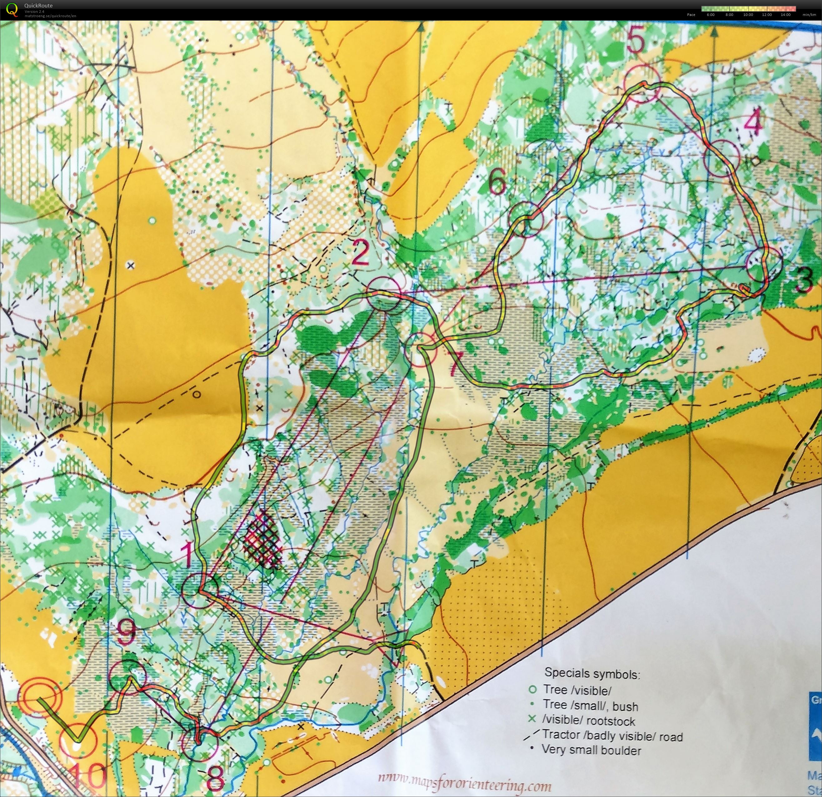
Distanza:
4.47 km
Tempo:
47:32
Media HR:
154
Massimo HR:
175
Toughest orienteering I've done for a looong time! The marshes were really bad and some people also saw bears on the course! Having survived with only minor mistakes to 3 (3') and 8 (1'), this was always going to be a good run and eventually resulted in a huge win!
Visualizza commenti
Nascondi commenti
(
0
)
Pubblica il nuovo commento
Nome:
Email:
Salva
 Italiano
 Česky
Česky Dansk
Dansk Deutsch
 Eesti
Eesti English
 Espa?ol
 Français
 Magyar
 Norsk
Norsk Polski
 Portugu?s
 ???????
 Svenska
 Türkçe
 ???????????