Archivo digital de mapas de orientación de Less Áron
|
Acceso
Todos los usuarios
|
Language:
Espa?ol
Česky
Dansk
Deutsch
Eesti
English
Espa?ol
Français
Italiano
Magyar
Norsk
Polski
Portugu?s
???????
Svenska
Türkçe
???????????
|
DOMA 3.0.6
Show overview map
Hide overview map
|
KML
|
Atrás
<< Szlovák VB 1. (2017-07-06)
|
Szlovák VB 3. (2017-07-08) >>
Szlovák VB 2. (2017-07-07)
Categoría:
Verseny
Mapa/área:
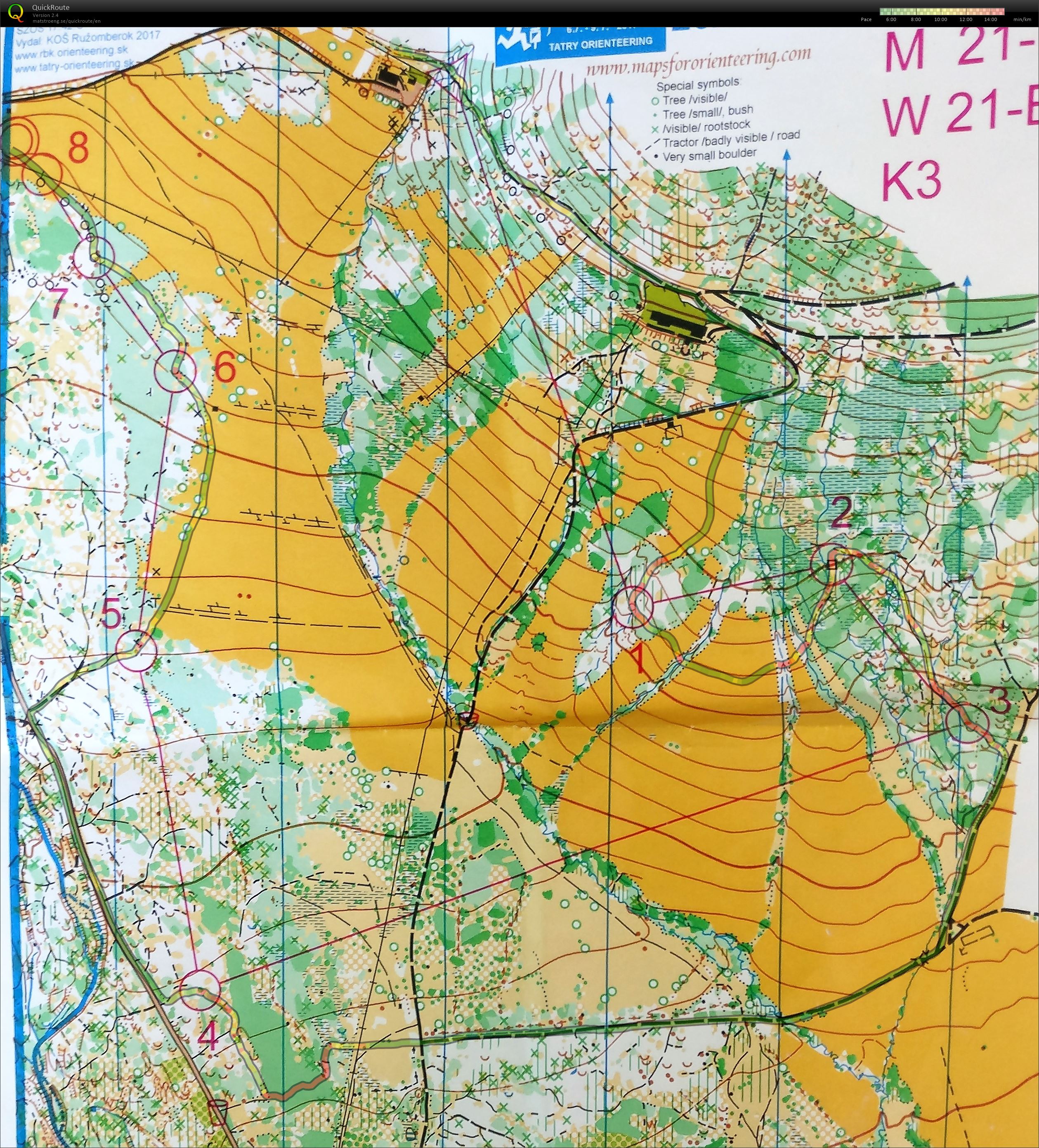
Prybilina
Organizador:
Tatry Orienteering
País:
Szlovákia
Disciplina:
long
Resultados
Distance:
5.3 km
Time:
43:57
Average HR:
148
Maximum HR:
180
Easier course than E1. It was much appreciated in the heavy rain. The ruins of the "forest" in the beginning were dreadful to run in...
Show comments
Hide comments
(
0
)
Post new comment
Nombre:
Email:
Guardar
 Espa?ol
 Česky
Česky Dansk
Dansk Deutsch
 Eesti
Eesti English
 Français
 Italiano
 Magyar
 Norsk
Norsk Polski
 Portugu?s
 ???????
 Svenska
 Türkçe
 ???????????