Digitalní archív orienťáckých map pro Less Áron
|
Přihlásit
Všichni uživatelé
|
Jazyk:
Česky
Česky
Dansk
Deutsch
Eesti
English
Espa?ol
Français
Italiano
Magyar
Norsk
Polski
Portugu?s
???????
Svenska
Türkçe
???????????
|
DOMA 3.0.6
Zobrazit náhled na Google mapě
Skýt náhled na Google mapě
|
Otevřít v Google Earth
|
Zpět
<< Tahanovský Grand Slam (22.04.2012)
|
Szlovák VB 2. (07.07.2017) >>
Szlovák VB 1. (06.07.2017)
Kategorie:
Verseny
Mapa/oblast:
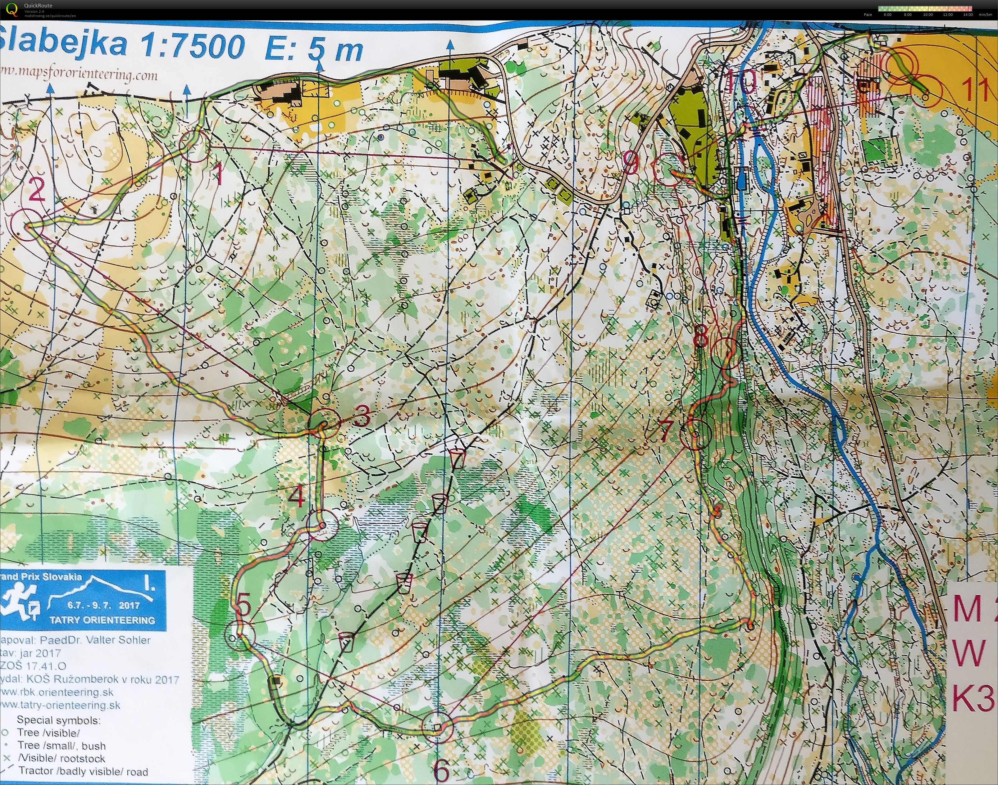
Prybilina
Pořadatel:
Tatry Orienteering
Země:
Szlovákia
Disciplína:
long
Výsledky
Skutečná délka:
5.47 km
Čas:
57:20
Prům. tepy:
148
Max. tepy:
186
Fantastic terrain with some really difficult parts (3 and 7 in particular). Really strong experience! Missed a lot, but this is why we orienteer ;)
Zobrazit komentáře
Skrýt komentáře
(
0
)
Napiš komentář
Jméno:
Email:
Ulož
 Česky
Česky Dansk
Dansk Deutsch
 Eesti
Eesti English
 Espa?ol
 Français
 Italiano
 Magyar
 Norsk
Norsk Polski
 Portugu?s
 ???????
 Svenska
 Türkçe
 ???????????